
Grand Canyon National Park rim-to-rim hike has been on my list for years. When a friend offered us permits, it was a no-brainer.
After sunset at Coral Pink Sand Dunes, we drove in the direction of Grand Canyon National Park. The plan was to stay at Kanab. However, all the hotels/motels were booked by the end of the day. One hotel receptionist recommended we drive a few miles to cross over to Arizona and stay at Grand Canyon Motel in Fredonia. And that was the best decision, super cheap motel and clean enough for a night stay.
Next day we drove to North Rim and camped at North rim campground that had to be booked months in advance. It was in the mid of May and there seemed no sign of rain stopping for the night. In an effort to keep the tents dry, we slept in the car, parked at the campsite.
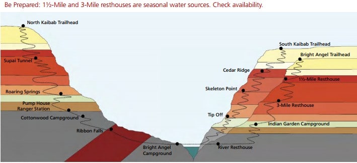
We started hiking from North Kaibab trail at around 7AM. We verified with the backcountry office that there will be potable water on the trail. These water sources are seasonal, so check before you head out on the trail.
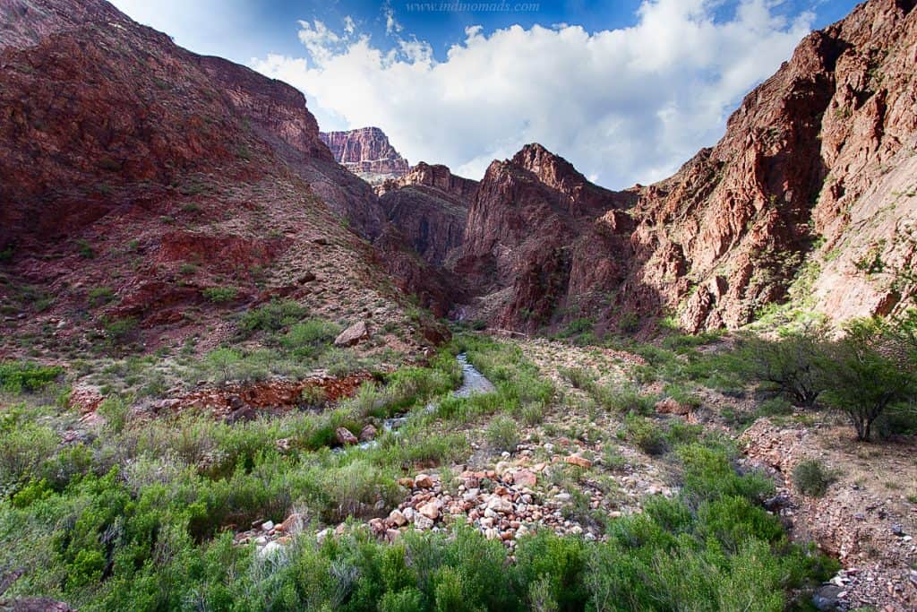
From North rim to Ribbon falls is approximately 8.5 miles of constant downhill, via cottonwood campground. With a heavy backpack, the downhill was no fun on the knees. We didn’t get permit to stay at cottonwood, otherwise, that would have been our choice to break down the distance.
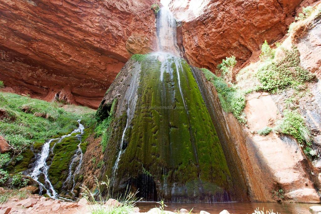
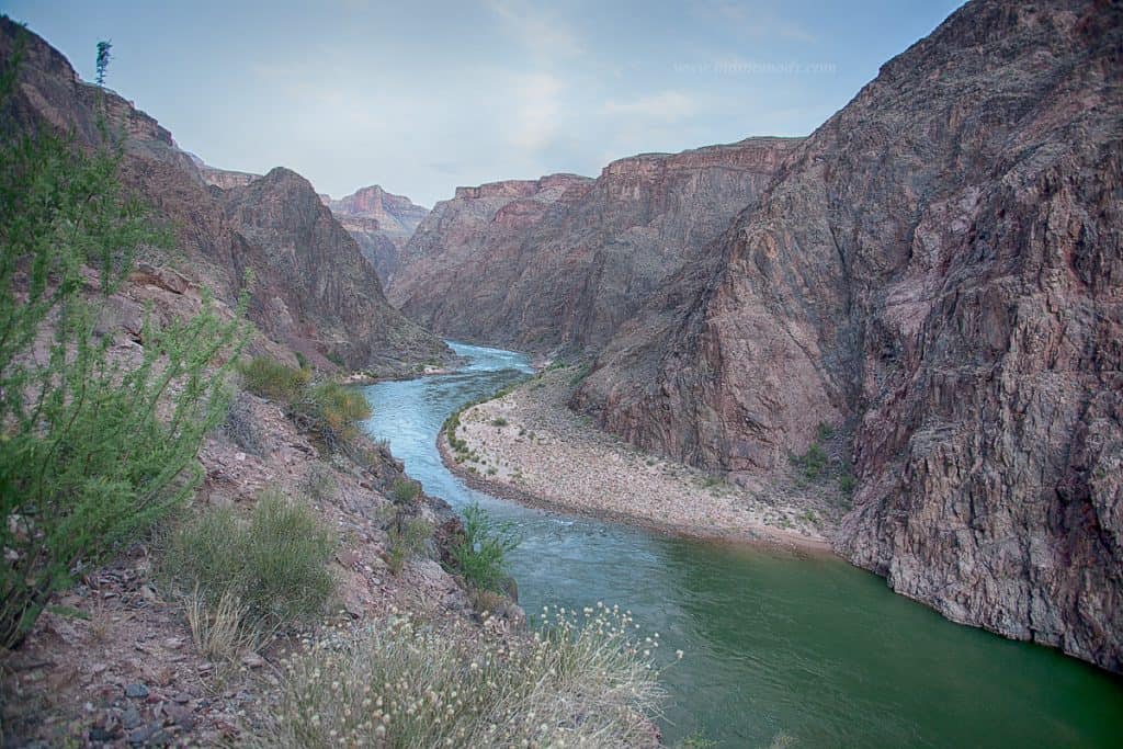
We reached ribbon falls for lunch and took a couple of hours break before heading out. The waterfalls is stunningly beautiful and a great way to cool off during the hot afternoon.
Ribbon falls is a small detour from the main kaibab trail. But, a stop thats well worth taking.
Around 3PM, we started hiking towards brightangels campground, which is another 7.5 miles away. From this point there is no other water source, so we had already filled water at cotton wood campground.
This section of the trail is pretty flat with little downhill, bit less taxing on the knee.

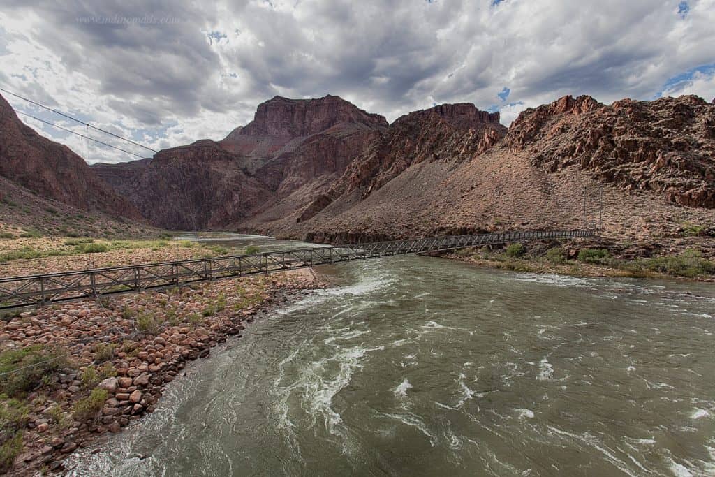
We had two nights at bright angles, best part of this campsite is you can camp right next to the stream and cool off during the hot day time.
The site here are not designated. You can pick anything available, provided you carry the permit. And yes, they do check the permit at the campsites.
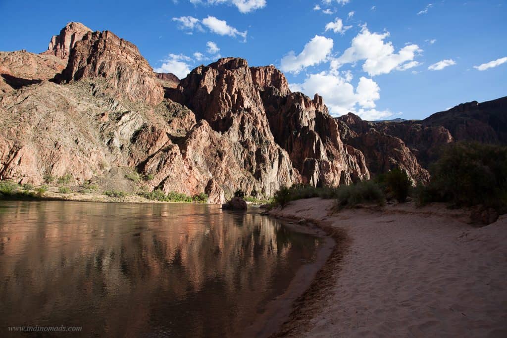
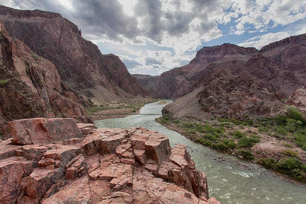
The colorado river beach access is just a little walk outside the bright angles campsite. It’s a place to watch sunset that with an awe of the nature.
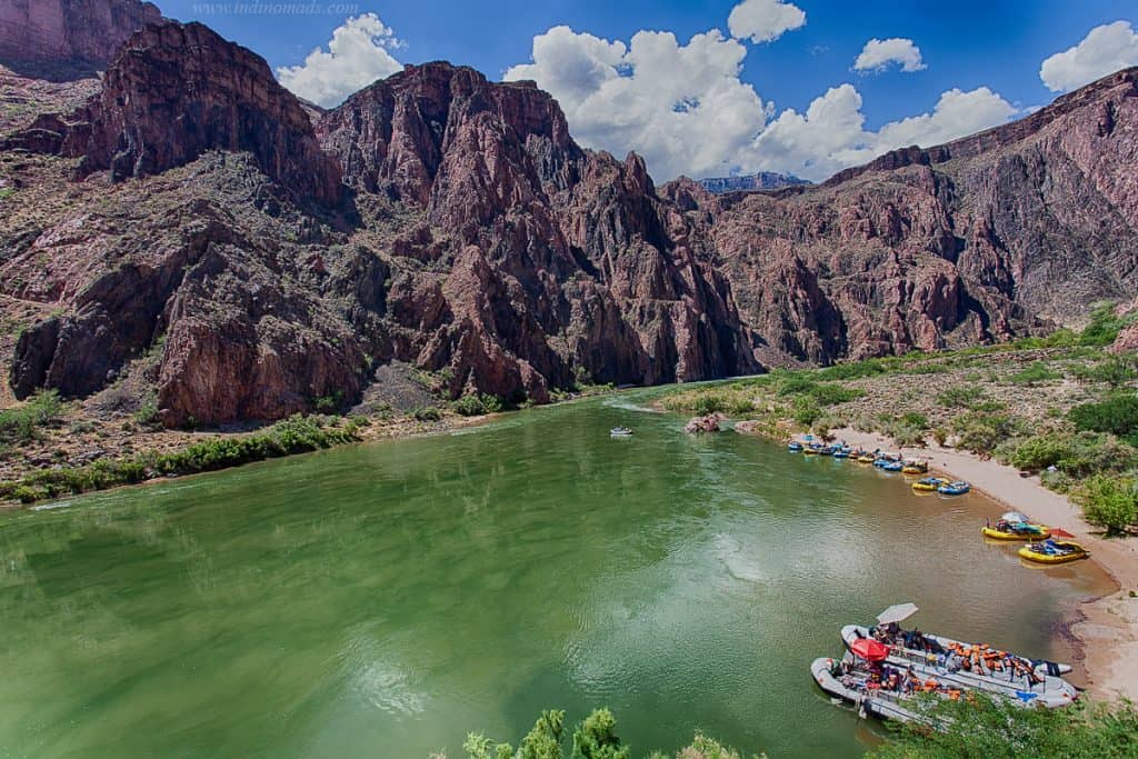
Next day, we didn’t have any plan, so we slept in, woke up very late, ate, walked around, socialized with fellow hikers, cheered on all the rim-rim-rim runners. There is a 2-mile river loop that gives some stunning views of the colorado river.
The two nights at bright angles we didn’t have to use the sleeping bag at all. Even at night, it was very warm and we just used it as a pillow. Had we known about the night temperature, we would have gladly avoided the sleeping bag and carried a couple of lbs less.
Same with jacket. Early in the morning, North rim is cold. For the initial part of the hike, its cold enough to wear a jacket, however, for the rest of the hike, its a dead weight on the backpack.
As far the food goes, we had dehydrated food at home and taken every snack (indian snacks) with us. At bright angles there is a store to buy basic things including beer and ice cream. But, if you need dinner at Phantom ranch (a hotel located next to Bright angles campsite), you have to book months in advance for both stay and food.
Third day, we started early in the morning around 5:30AM to beat the heat. We chose to hike bright angle trail, which is 10-miles of uphill instead of the south kaibab, which is 7-miles. Reason being, south kaibab is steeper and no water source.
Bright angles on the other hand goes through Indian head campground, where you can re-fill the water.
As the day progressed, it got hotter and hotter. We were a group of 5 and one finished in like 4 hours of straight climb. Chakri and I took breaks, pictures, and at my slow pace, we reached by 1PM I believe.
There is huge food court to eat at South rim and french fries was my victory food. We had arranged for the shuttle to pick us up at south and drop at North rim, where our cars were parked.
It was an epic 25-miles of hike. Heat, distance, backpack weight, elevation loss and gain, it’s no joke.
Here is how we trained:
- 8 weeks before the hike, we gradually increased the backpack weight to almost 30lbs and hiked at least 10-miles at PG&E trail at Rancho State park in bay area.
- We would go out in the afternoon for heat training.
Lessons learned:
- Pack a bit lighter, as usual this is one lesson we have hard time learning
- Check the weather and avoid sleeping bag if possible
Elevation chart of the hike:
(Source: http://www.rimtorim.org/wp-content/uploads/2011/05/Rim-to-Rim-Map-2.jpg)